
Make the setting clear
Aerial photographs show the relationship between the parcel, nearby roads, neighboring land and the wider landscape. Illustrative boundary graphics can help orient the viewer.
Explore the service →Land & acreage · Southwest Washington
Land photography and films that help buyers understand what they’re looking at—and picture what comes next. From a single wooded parcel to a multi-lot property, we bring the ground and aerial perspectives together.
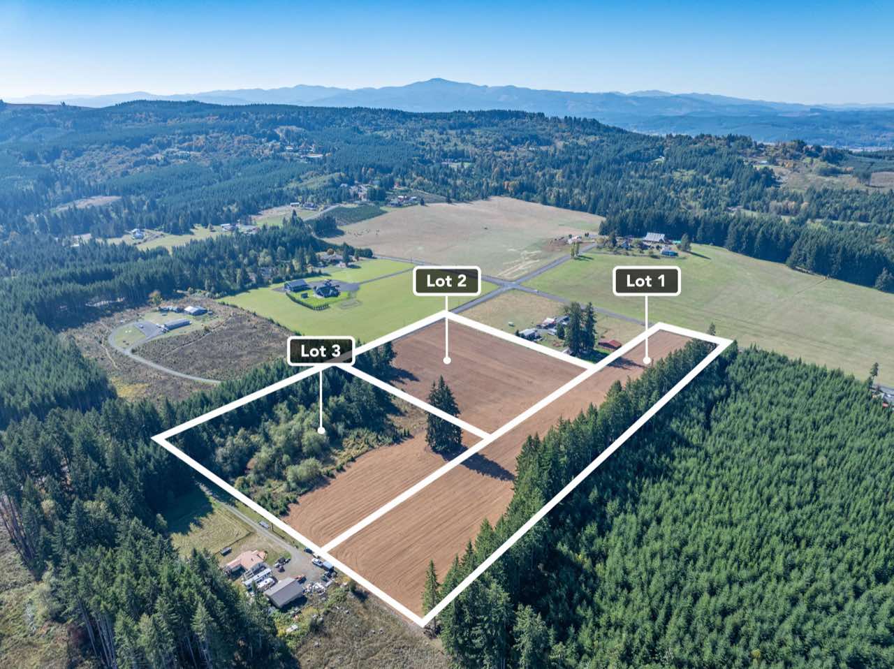
A drone view explains the shape and setting. Ground photographs give scale to the trees, approach, clearings and usable spaces. Together, they help an unfamiliar buyer connect an overhead view with the experience of being there.
Aerial photographs show the relationship between the parcel, nearby roads, neighboring land and the wider landscape. Illustrative boundary graphics can help orient the viewer.
Explore the service →A parcel film can connect access, key features and the surrounding views in one story. Narration can guide the viewer through a larger or more complex listing.
Explore the service →For pre-sale or development projects, we can discuss concept design and visualization that place a proposed use into its real setting.
Explore the service →When the land needs a little more explanation
Multiple lots, changing terrain or a community amenity can be difficult to understand from a map alone. Films, narration and visual guides bring those pieces together.
At Oakland Bay, a custom film connects four lots, the landscape and a community beach.
At Summit Lake Road, aerial views and narration introduce multiple lots, with a day-to-dusk effect woven into the ending.
Sherman Road uses a more graphic-led approach to explain the land. Coverage and visual guides are planned around the features of each property.
Explore ground-level details and aerial perspectives. Select a photograph for a closer look.
A few real projects
Chehalis · Lewis County
Ground photography, aerial views and film for a land listing.
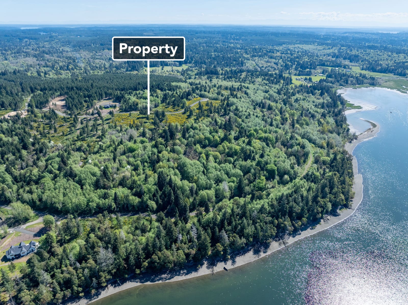
Shelton · Mason County
A custom film connecting four lots and a community beach.
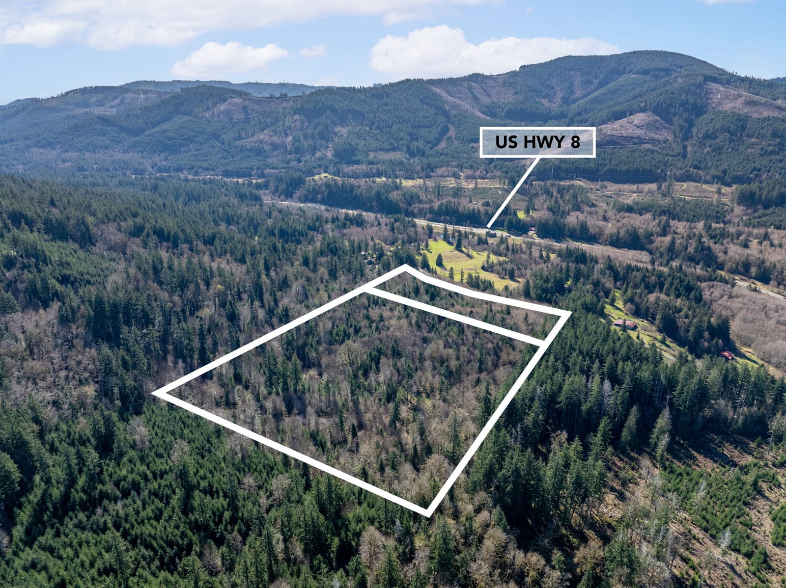
Summit Lake Road · Washington
A narrated parcel preview showing multiple lots and their surroundings.
In our clients’ words
They capture both land and homes beautifully using drones and more to showcase properties in the best possible light. Their communication is excellent, and their customer service is top-notch. Highly recommend!
Michael and Elise do an amazing job with their real estate photography! They capture both land and homes beautifully using drones and more to showcase properties in the best possible light. Their communication is excellent, and their customer service is top-notch. Highly recommend!
Send the parcel numbers, available maps, the preferred access point and any gate instructions. Tell us which features matter most, whether there are multiple lots or buildings, and where we have permission to go.
Yes. Ground coverage can show details that are harder to understand from above, such as an approach, a clearing or the feel of a wooded area. We’ll plan the coverage around access, conditions and your marketing priorities.
Boundary graphics are illustrative marketing aids. They are not a survey or a legal boundary determination. We work from the property information supplied and discuss anything that needs clarification.
Tell us about extensive acreage, multiple parcels, outbuildings or a more involved film. Our land pricing covers common scopes; larger or unusual projects can be reviewed with you before booking.
Explore land coverage, or talk with us about a custom project.
Meet your Lewis County media team →